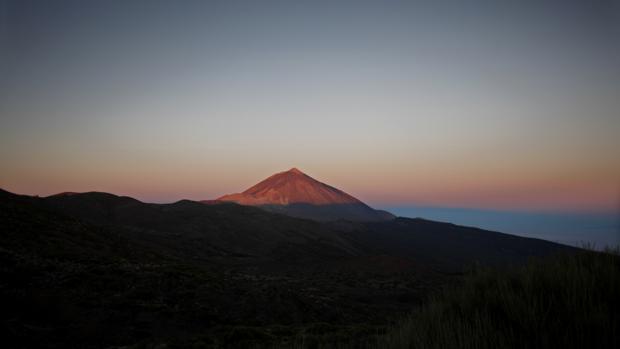
Teide National Park with a total of 8.6 million visits is the world’s eighth place visited by users of Google Street View, an integrated Google Maps application. Mount Teide, 3rd highest volcano in the world and the highest point of Spain.
In a note from the Cabildo of Tenerife gathered by Europa Press is reporting that the island’s Minister of Tourism, Alberto Bernabé, stressed that “thanks to this tool, those wishing to explore the Parque Nacional del Teide if they have not been before can do it in a novel way. ”
Turismo de Tenerife and the Factory of the Tourism Innovation Canary reported in the note that have supported this initiative by the company team “Crea Solutions”, which has developed a collection of more than 300 panoramic images of Teide, so the user can take a virtual tour of the National Park as if it were physically there. The Cabildo, through Tourism of Tenerife, has developed a virtual experience as from those images.
With an altitude of 3,718 meters above sea level and 7,500 meters above the ocean floor, the Teide is the highest peak in Spain.
Explains Francisco Ortiz Ocaña, creative Crea Solutions, “the process that ended with the publication of this hercúlueo effort photographers, coordinators, developers and programmers In early 2014 began with the corresponding permit applications to the management entity of the National Park, who they facilitated the necessary permissions to access the top and carry out the work of photography, which took place in several phases, being published, from an altitude of about 3,543 meters to 3708 meters in the crater.
Courtesy of Abc, AFP PHOTO / DESIREE MARTIN